Following the discovery of dead fish and foul odors at Turan Beach in Izmir, scientists are urgently working to identify and address the sources of pollution
A team of researchers from Manisa Celal Bayar University and Yıldız Technical University is actively mapping pollution in Izmir Bay by utilizing advanced satellite imagery techniques.
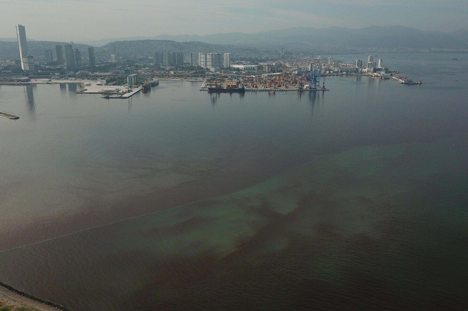
This initiative comes in response to a troubling incident on Aug. 20, when dead fish washed ashore and foul odors emerged along the Turan coast in the Bayraklı district in Izmir Bay on the Aegean coast of Türkiye, prompting urgent action to identify and mitigate pollution sources.
The Ministry of Environment, Urbanization and Climate Change has established a Science Committee that is currently developing an emergency action plan. Meanwhile, scientists from various universities are collaborating on projects aimed at addressing this pressing environmental issue.
Using the Google Earth Engine platform, the researchers have written code to analyze Sentinel satellite images. They employ remote sensing techniques to classify light rays reflected from the sea surface, allowing for the rapid detection of pollution changes.
By measuring chlorophyll A density in water bodies through the Normalized Difference Chlorophyll Index (NDCI), the team can monitor phytoplankton and algae presence in real time.
The resulting maps clearly illustrate the pollution levels in Izmir Bay, with the most contaminated areas marked in red and progressively less polluted regions indicated in lighter shades. According to Osman Salih Yılmaz, a faculty member in the Geographic Information Systems Department at MCBÜ, this method serves as a rapid scanning tool for tracking water quality, akin to medical imaging techniques like X-rays and MRIs.
Yılmaz explained that the satellite's revisit time for an area averages five days, enabling the team to track changes in pollution levels consistently. Their analyses show that pollution in Izmir Bay remained below threshold levels from 2017 until mid-2024.
However, a recent surge in chlorophyll A levels linked to algal blooms has been observed across nearly all regions in the last three months, particularly along the coastlines of Bayraklı, Karşıyaka, Konak Pier and the Port of Alsancak.
"This system can be instrumental in future studies conducted in the bay,” Yılmaz noted. He emphasized the importance of integrating their findings into early warning systems for Izmir Bay, stating: "We have conducted an MRI of this issue. After identifying the exact cause of pollution and implementing treatment, we can monitor the effectiveness of our efforts.”
The collaborative research team includes Osman Salih Yılmaz, Ali Murat Ateş and other faculty members from both universities, building on previous studies that mapped the spread of mucilage in the Marmara Sea and assessed areas affected by forest fires in the Mediterranean region.
As these efforts continue, the research team remains dedicated to improving water quality and addressing the environmental challenges facing Izmir Bay.